Pendleton to Salem
You know what? You got out to Pendleton, you can get to fucking Salem on your own. Just take 84 west. Drink water out of the Columbia, it won’t kill you. Hood River has a hotel – it’s expensive, but I’ll bet you can afford it. Once you get to Troutdale, what there is of it, turn south and pick your way to I-5.
Stay out of Portland, we don’t want you here.
–Flatnose Mike
Oregon border to Pendleton
Hey, so Mike passed this onto me with the rest of the parcels. Said I’d get some beer out of it if I noted where to stop and stuff on it. Sounds good to me.
I’m new to the route, so I don’t really have that much in the way of detail for you. But I suppose if you made it here from Kansas you’re old hands by now and can take care of yourselves. I’ll give you the basics and trust you to manage the rest on your own.
Given that you’re leaving from somewhere past Nama like Caldwell or Ontario, your first stop will probably be at the southernmost tip of the Brownlee reservoir. (Don’t head west out of Ontario, whatever you do. There are a few spots to get water as you go through east Oregon, but then you hit the Great Sandy desert and... well, it’s a desert. No water. People still die every year trying to cut across the basin. It’s a bad idea, head north.) It’s a narrow little lake, I’ve heard it’s always cold and know first hand that it’s nice to take a dip in (in the summertime, at least). Next stop is Baker. The town’s not in very good shape, but there’s water there – intermittently. It is called the Powder River for a reason. By the end of the third day you should be up in La Grande, and at Pendleton the day after that. These distances might look long to you, but get up early as possible and stop before noon, then do a little more traveling just around dusk and you’ll be surprised how quickly it goes.
One catch on your way further west is the Umatilla. The interstate runs right through their (former?) reservation, and a lot of them aren’t so friendly to white folks or folks of any color other than red anymore. Sure hope you don’t, but you might get stopped and hassled a little bit. They’ll pretty much let you through if you share a bit of grain or some whiskey with them. But... yeah, don’t give them any whiskey, OK?
–Ozzie Blue
Pocatello to Oregon border
I’m only working this range ‘till I can get enough kit and barterables and cash – near-worthless as it may be – scrounged up to move out to Hood River, myself. Might be able to find myself a little bit of land or work into a range as a courier. Nice area up there, and thanks to you and your benefactor for helping foot the bill for me to get out of the basin. I appreciate it.
Not that the area’s all that bad. Folks are helpful enough, if you ask them, but they’re not overtly friendly. Chances are that by the time you get up this way, you’ll have experienced a lot of that. Don’t know what to say, except mind your step if and when you get off the interstate and ask first before you help yourself to water. There’s a decent enough supply of it, at least through the eastern part of my route, but people can get protective. If you’re sharp, you’ll see that the folks in American Falls still have a gallows all put together. They strung up a few punk indians and a white kid who were looting their way west last summer. They probably could have just gone on through with no trouble, but they killed an old couple in Bannock. Scalped them with a hatchet, honest to God. Apparently, they didn’t expect to get caught – as they got found out up on the reservoir the day after, just lounging around like lollygaggers – but they were hanged lickety-split. The mob left them there for several days, right in sight of the interstate. Nasty business, and the stench of them made riding by to and from Boise real unpleasant.
You won’t have to worry about anything like that, though. Again, ask first, be polite and you’ll do fine.
Get food and whatnot in Pocatello. It’s not great for mechanical work, but if your wagon is draggin’, someone will patch it for you. Take I-86 out of Pocatello and you’ll get to American Falls in one day. Day after that, head on down to Raft River. There’ll be a sign for it, but it’s not a town. Just a place folks used to take their boats into the river. Good water source, good place to camp. Third day, try making it over to Greenwood. That’s less than fifty miles, and there’s another good water source. Fill up here, because the next couple days will be pretty dry. 86 will merge with 84 but you won’t really notice it. Day four, you’ll swing up to the northwest. Stop in Jerome – there are a couple creeks in the area, but you can’t expect them to be running in the mid-summer, much less full. Don’t stop in Twin Falls unless you want to get gouged for wormy wheat. Day five get up really early and plug your way to Glenns Ferry. You’ll meet back up with the Snake there, and you’ll be glad to see it. Day six swing back to the northwest again and stay in Mountain Home. There’s no real water in town, but a nice lake – they call it a reservoir, but it’s pretty small – just to the northeast. Day seven ride on up to Regina and stay the night. The stream can be intermittent, but there’s a pond/lake just to the west. A very short day’s ride after that will get you into Boise.
Boise’s been through a rough time the past couple years, and it’s become a rougher place for it. Chances are you’ll need to resupply, and Boise’s still the best place for that, but get out to Nampa quick as you can. It’s a bit safer there, and there’s an excellent reservoir there. Don’t be surprised, though, if you get requests from folks in both Boise and Nampa to deliver their letters, parcels or whatever out west. The courier service between western Idaho and the coast has not been real great lately. Whether it was raiding or just a flaky courier – hard for me to say. The way Ozzie makes it sound, though – and I’m taking it with a grain of salt, as I’d never met him until just a couple days ago – things are back on the up and up. Still, that news takes time to filter out to folks.
Anyway, once you’re out of Nampa, just shoot for Fruitland or Ontario. One day, a little bit of up and down in the middle, but nothing you won’t be able to handle if you’ve made it this far. There’s not too much in either of those towns but water from the Snake. Best of luck from there on out. –Andy Hill
Provo to Pocatello
Greetings fellow travelers! With some hard working animals, patience and a little bit of luck you’ll be out my way before mid-summer... maybe? Not sure how long it’ll take you to cross Kansas, Colorado and the lower – and, let’s face it, far nastier – part of Utah. Regardless, once you get to Provo, you’ll find your luck turning. Except for a small glitch or two mentioned above and herein, almost every place and everyone from here on out will be vastly more hospitable to you.
I’ve got a pretty nice little route here: Provo, UT to Pocatello, ID. Now, Provo’s not a bad little spot. You can rest for a couple days, there are a couple decent greengrocers and at least one very good mechanic who can patch your little red wagon (or whatever it is you’re bringing out... because you’re not riding, are you?). So restock and pull maintenance – these folks aren’t hard to find, just ask someone when you get into town. You might get ignored by a few (read on) but just keep asking others and someone will talk to you. Then, when you’re ready, get up early and mosey on up I-15. The first day is going to be your longest, but you’ll be ready for it.
I don’t know how much you know about the Mormons, their belief system, etc. I’ll confess to knowing next to nothing about it, myself. But once the world ended, you know, the whole Mormon community – so basically all of Salt Lake City and a whole bunch of others in Utah – went a little bit nuts. They have basically taken to not speaking to anyone outside their faith, effectively cutting themselves off from, oh, the rest of the world. In response, virtually all of the other folks in the city moved out to the surrounding communities (or states). So, with that in mind, there is really no point at all in stopping in Salt Lake. Now, nobody is going to hassle you or give you a hard time, but if you break down, nobody is going to help you. So, I say again, be sure to pull some maintenance in Provo.
Now, getting back to that first day. You’ll stay on I-15 all the way through SLC. Try to get to Farmington that first day. It’s 70 miles, give or take a few. That’s a long day, no doubt, but again, you’ll be well-rested and the route is not challenging in the least.
Next day, shoot for Honeyville or Tremonton. You’re still solidly in Mormon turf, so don’t expect friendly receptions. They won’t stop you from getting water from reliable sources, though, so avail yourself.
Day three, continue on I-15 up to Malad City, ID. I know you’re looking back and forth at your map now and saying, what? OK, if you head northwest on I-84 you’ll shave about 60 miles off your travel time. So why keep on going north? Well, there are better water sources on I-15, a great water source and resupply point in Pocatello, and water all the way down to where you meet back up w/84. It’s up to you, but you’re in for a dusty trip through south-central ID if you head west too soon.
Spend a night in Malad city, and cross over Malad Summit and head into Arimo the next day. There’s a good creek there. Day after that just continue on up 15 until you get to Pocatello. Then you can get more water and head out west from there, and best of luck after that!
Hey, if you’ve got a day to spare in Provo – and after the trip through eastern Utah, you’ll probably need an extra day or so of rest – just drop by the Vineyard (general vicinity marked on the map for you) and ask for me. I’m originally from Olathe, KS, and still have some friends out that way... I think. So, I’d like to catch up a bit. We don’t get much news from out east, it would be really nice to have an update. Happy trails! –Sal A. Mander
Grand Junction to Provo
Don’t even know why I’m going along with this. I’m seeing what, like ten percent or so of the value of that beer? What is that, like a few gallons or so? And I’m not even getting the beer, just market value in scrip or some bullshit – great, more fucking sweet corn. What the hell ever. Guess I don’t have anything against you, whoever you are, and it’s not all that difficult for me to scrawl a few notes on the map... and one fewer dead family along this road is one fewer I have to smell on the way to and from Grand Junction.
So. Leave out of Mack. Not Grand Junction or Fruita. Mack – it’s the last place in almost 100 miles you’re going to see anything resembling a stream. Stock up on veggies there or before – in Palisade! – then fill up every fucking vessel you have in Mack, drink till you’re about to burst, leave before dawn and get as far as you can while it’s cool out. With a little luck you’ll make it to Cisco or thereabouts before the sun gets to be too intense. You can look around for water there, but don’t expect to find any, and don’t expect any you find to be potable – one mudhole in particular still has a couple dead deer in it. BAD WATER. Just get under some shade – oh, yeah, and you’ll have to bring your own of that. You might want to travel a bit at dusk, just to get a bit further along. Up and at ‘em the next day, just as before. You should make Floy without any real problem. You can stay there and scrounge around for water or try pushing on to Green River – about fifteen miles further. There’s a decent little river there. Fill up again, just like in Mack. Woodside’s a half day’s ride away after that, heading up highway 6. Then Wellington, the day after that. Buy whatever shitty, overpriced food and supplies you need in Wellington and spend the night there. Next day get up the pass. Don’t waste time in Helper, just get through the fucking pass and take highway 6 – it’ll go to your LEFT! Spend the night in the canyon and get down to Soldier Summit or Gilluly the next day. You might find water there, but probably not. After that you should be able to get into Provo. Don’t stop in town, just ride your happy ass on down to the bay and drink your fill. It doesn’t taste very good, but it is freshwater. This is all really short, I know, but there’s really not much to it except enduring it. You’ll be hauling your ass through some nasty desert country and over a pass, and it’ll probably be the worst part of your entire trip. You’ll be in for more weirdness than you can figure as you head up north. Sal mentioned it, but I don’t think any description will enable you to fully grasp what Salt Lake City will be like. (He’s a little touched in the head, himself, if you ask me.) That place is fucked. But, of course, weirdest doesn’t mean worst. If you make it past the Moab area, you should have smooth sailing. Oh, and consider taking a hot bath up in Saratoga Springs, on the northwest side of the lake. ‘Cause by now, you stink. –Jan W.
Pueblo to Grand Junction
I know the other legs have told you how to get from east to west. Well, my brain can’t do that backwards-ass route stuff too easily, and I put off making notes until getting to Pueblo and Ron’s looking at me like I’m letting the air out of his tires as I write this down, so you’re going to have to deal. It’s not that hard really – the route planning that is. But forget what the other folks said, this will be the most difficult part of your trip. Most of it will be pleasant, but one part in particular is a make or break deal.
So, Grand Junction. What can I say except that it’s a shithole these days. You’re going to want to get in and out as quickly as humanly possible, and don’t even think about spending the night there. But, it’s a natural stock-up point for you, so before you go, hit one of the smaller communities just to the east. Best one is Palisade. Buy as much damn produce as you can carry there – it’s good and cheap! Head out of the Grand Junction area on highway 50. It’s probably a day’s trip between there and Delta, then another between Delta and Montrose. Now take your time in here, keep yourself and your animals healthy and well-fed and watered. Take another day to get from Montrose to the reservoir, and another to get from the reservoir to Gunnison. Again, pace yourself! All these roads are going to be passable in the summer and into early fall (right now they fluctuate between shitty and phenomenally shitty). Once you get to Gunnison, take a day’s rest and re-stock. You won’t think you’ll need to, but you’ve got to be prepared at this point. Now, take a day to get to Sargents or thereabouts, then rest. Next day, mount up early as you can, ‘cause you’re heading up Monarch Pass through the Great Divide. If you follow advice well and your animals are in OK shape, you’ll get to the top mid-afternoon. You’ll be tempted to head down that day, but for Christ’s sake don’t! Your horses are going to be more tired that you can possibly imagine, so make camp that night best you can. There can be some weird weather in the pass, so be ready for lightning or odd squalls to blow up. They typically don’t last long, but they can be pretty bad. There’s an old restaurant/tourist trap place up there that’s out of business now, you can probably wedge yourselves in there if the weather gets nasty enough. Next day you should be able to make it into Salida – go easy on your horses heading down the pass. From there, just take it one day at a time again. Salida to Canon City, rest. Canon City to Pueblo, rest. Restock in Pueblo – there’s a good reservoir just to the west. Food’s a bit more expensive there, but it’s worth it to not have to go north for anything.
Now just switch the comes to gos and froms to tos and vice versa and you’re golden.
Now, OK, you’re probably thinking, why couldn’t I just take 70 west from Denver to Grand Junction. Well, you could. Could. But if you did you’d regret it. It can be difficult getting through Denver these days, and I-70 from there isn’t the best route to begin with. Tunnels get blocked with snow or boulders. I know that’s not much detail, but trust me when I say that it’s just not a good route for you to take.
I’d wish you luck, but I don’t believe in it. –Bridgestone BOB
Hays to Pueblo
First off, as a general rule, try to get as much traveling done as possible in your mornings. It’ll be cold when you roll out, but will warm up pretty quick, and in the summer there are regularly afternoon thunderstorms right up on the front range. They can be severe enough to wash you off the road, so if you need to, stop and find some way to anchor your buggy or wagon or whatever’s taking you out west.
OK, day one: Hays to WaKeeney. This’ll be as easy a day for you as there will be on this entire trip, assuming you rested up a bit in Hays (and didn’t get a whiskey bottle smashed over your head) or wherever it is you last stopped. If you don’t have any water or run out, you can take a hardtack road – no dirt roads! – a mile or two south or north and there’ll be a stream in just a few miles. Big Creek, to the south, is the closest and best but can be intermittent and the farmers around there are a little overprotective at times.
Day two: This’ll be a long one for you. WaKeeney to Oakley. Won’t be a bad little ride, just long. Head out as early as you possibly can so you can make it into Oakley before dusk and get more water. Also, visit the gigantic prairie dog shrine out there. Weird. You’ll definitely want to water up in Oakley, because the next leg is a doozy.
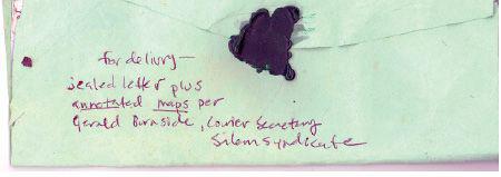
Day three: Taking I-70 up to Colby and west from there seems like a natural. Don’t go that way. Since BBOB had to bite his tongue and dissemble a bit about it, I’ll explain a bit. Denver has become a tightly-controlled syndicate town. Virtually nobody comes in or goes out without the approval of the mob. They have roving bands of thugs just cruising all around the city, scouting things out, stopping folks who are getting around by any other means than walking, and administering beatdowns if necessary. That’s all they do. It’s been like that since a year after the lights went out, and has only gotten worse since a fire wiped out a huge chunk of town a few years back. They’ve even got an outpost of ex-cons in Burlington, just over the Colorado-Kansas border – not worth tangling with. And anyway, you wouldn’t want to go north or west out of Denver. But BBOB and everyone else have covered that much. So, save yourself the trouble of going northwest to Colby (then having to swing back south to go to Colorado Springs or Pueblo) by just taking highway 40 west out of Oakley. It’s a decent road, and you’ll be able to get to Wallace or Sharon Springs by late afternoon, anyway.
Day four: OK, you’ll cross into Colorado today. You’ll be able to get to Cheyenne Wells, at the very least, but probably won’t be able to make it to Kit Carson. Stop in Firstview. It’s a nowhere town’s nowhere town, man. Nothing there, not even a bar.
Day five: Head over to Kit Carson in the morning. Then you’ll have a decision point. You can stay on 40 west or take 287 south. Depends on whether you want to head into Colorado Springs or Pueblo before tackling the Great Divide. Personally, I’m partial to Pueblo. The water sources on the way there are a bit more reliable, and the route itself is less severe. But I’ll describe the first route quickly. To get to Colorado Springs, take 40 west to Aroya, then 94 all the way into the Springs. There are a few creeks in between Aroya and Colorado Springs, very little in the way of people. Should take you two and a half, maybe three days to get there from Kit Carson. Now, to get to Pueblo, take 287 south. Don’t stop in Eads, you should be able to get past it and to a reservoir around there within one day. Day after that head down past Wiley and take highway 50 west up the Arkansas. Plenty of water and a decent road! Should take you a couple days to get into Pueblo after turning west.
From Pueblo or Colorado Springs, it’s up to you. –Ron Hightail
Lawrence to Hays
Not sure if I understand the entire concept correctly. You’re moving out to Oregon, I got that. But you’re – how are you going? It sounds like you got kids, so I hope to Christ you either own a good, converted compact car as a wagon and a few damn strong horses or a couple unobtainium-light tandems with strong kids as stokers and a couple decent cargo trailers. The other legs sounded like they thought you had animals. Being half-camel wouldn’t hurt, either, but anyway... hey, look, the letter and accompanying junk made it this far, so it’s possible. Guess you should look at it that way.
I’m assuming you know how to get from De Soto to Lawrence. If not, you’d best just cancel your plans right now, because you’re sure as hell never going to be able to figure out how to traverse half – and the arid, most mountainous half, at that – the continent. So, you get to Lawrence. Whichever way you came into town, you’re going to want to take I-70 out. There are three place to get on the interstate, not that hard to figure out. Stay on 70 through Topeka – don’t take 470 or you might get confused. Now, you’ll probably be tempted to stop in Topeka. That’s your call, but if you push through town there’s a nice stream just a few miles to the west. Good place to rest people and animals. The next place you’ll really want to take a rest is Salina. You might think you can make Junction City in a single day. It’s possible, but don’t. Don’t stop in Junction City, don’t even look at it as you’re passing through. It’s not clean and not safe. You could stay a night in Manhattan, but it’s a ways off the route. Best to just camp by a small stream wherever you can find one. Sure hope you have a decent tent or something. So yeah, stay another night in Salina. River’s just east of town, for watering your horses if you have them. A couple stores in town, so stock up on food if you need to and sundries. Fill up on water here! Things get drier the further west you go. There’ll probably be a stream here and there for you, and there’s a good lake just north of Wilson but it’s off the beaten path. Actually, staying in Wilson is probably your best bet. If you need water, you can make a sidetrip up to Wilson Lake. Another day, probably, and you’ll be in Hays. Like the last guy said, steer clear of the bars and anywhere along the main drag at night, it can be a rough town these days. Fill up on water again and God speed you the rest of the way. If you see a guy on a mint green bike, that’s me. Wave if you feel like it, but don’t bother stopping.
– B. Onkey